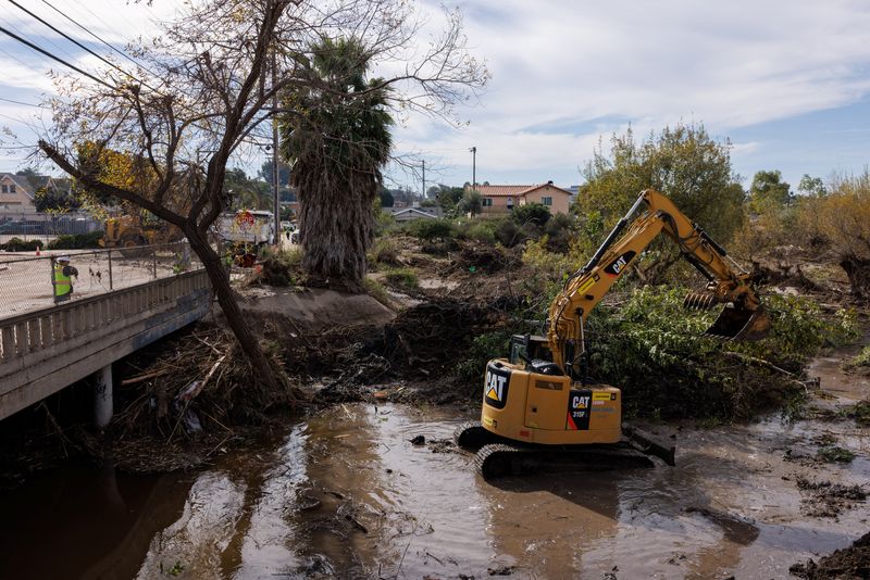
©Reuters. City workers begin to clear debris along a drainage ditch that overflowed causing flooding in adjacent neighborhoods after a heavy rain storm in San Diego, California January 26, 2024. REUTERS/Mike Blake/File Photo
By Steve Gorman
LOS ANGELES (Reuters) – California faced two back-to-back storms in the Pacific on Wednesday that were forecast to drench much of the state with heavy rain and could cause widespread flooding, while snow at higher elevations could help replenish supplies of fresh water.
The first of the storms — both produced by vast air currents of dense moisture called atmospheric rivers — hit the West Coast on Wednesday, bringing showers and gusty winds from southern Oregon to northern California and the San Francisco Bay Area.
According to Daniel Swain, a climatologist and meteorologist at the University of California, Los Angeles, the two systems also fit the definition of the “Pineapple Express,” or Pacific storms originating from the warm subtropical waters around Hawaii.
The initial storm was expected to sweep into Southern California on Thursday, where residents – still reeling from flooding in recent weeks – rushed to stack sandbags and clear storm drains in anticipation of another onslaught.
“We’re going to fill 40 tons of sandbags in this recreation center,” said Scott Webber, 27, a building contractor helping with storm preparations in a San Diego County neighborhood where dozens of homes were flooded on Jan. 22 .
“This morning we transported 25 tons” to another voluntary sandbag collection site, he added. “People need to have each other’s backs.”
The winter storms — the first of the season — mark a sharp change for California, which like much of the West has been basking in record late January heat since the weekend.
The initial storm was expected to intensify in the Bay Area Wednesday evening. Precipitation will fall mostly as rain, with 2 to 5 inches of precipitation possible in San Francisco through Thursday, while snow is expected in nearby mountains.
The National Weather Service has issued a flood warning for the Bay Area and California’s central coast, along with a high wind warning for much of the region.
Flooding of roads and streams was possible in Southern California on Thursday, although large periods of flooding were considered less likely, according to Swain. Heavy to locally very heavy rain from the system could persist over parts of Northern California for 6 to 12 hours, he added.
SECOND STRONGER POINTS FORECAST FOR SUNDAY
A second, potentially more powerful storm is expected to hit California on Sunday, bringing strong winds to the north and much heavier showers to the south, dumping even more snow on the mountains.
While much of the second storm’s trajectory remains uncertain, Swain said it appears to contain a denser plume of moisture capable of unleashing heavier, more prolonged rainfall.
“Suffice it to say, there will be some flooding in Southern California,” Swain said. “The question is whether this is the insignificant street flooding we see in every major storm or something considerably more significant.”
San Diego County suffered record rainfall and severe flash flooding from a localized storm last week, and parts of Ventura County were evacuated after a month’s worth of rain fell in just one hour in December.
However, the precipitation forecast for California pales in comparison to that of Anchorage, Alaska, where a storm this week pushed seasonal snowfall totals for the state’s largest city past the 100-inch mark earlier than ever in the winter .
A series of about a dozen river-like atmospheric storms hit California in quick succession last winter, triggering mass evacuations, power outages, levee breaches and road closures in a state long troubled by drought and wildfires. At least 20 people died in those storms, but they helped break the grip of a years-long drought in California.
The latest storms are similarly expected to help improve the state’s water supply picture by strengthening mountain snowpacks, currently lagging at below-average levels.
Although the West Coast of the United States has averaged 10 or 11 river storms per year since 1980, they are expected to become more frequent and extreme over the next century if planetary warming due to human-induced climate change continues at rates current, according to scientists.
The latest two storms are also typical of the prevailing El Nino weather pattern, a natural deviation in the Pacific jet stream that causes warmer-than-usual ocean temperatures along the western coasts of North and South America, Swain said.